Geodesy, land management and cadastre

Geodesy, land management and cadastre

By Developer, 29 September, 2020
Переглянути на сайті
Email
Ul.anna@vnu.edu.ua
Location
43026, Lutsk. Kravchuka st, 36, building K.
Head of department
Content
File
StrategyOPP.pdf (138.71 KB)
E+WURZ.pdf (3.17 MB)
1-20.pdf (176.04 KB)
2-20.pdf (167.59 KB)
2-21.pdf (166.16 KB)
1-22.pdf (170.32 KB)
1-21_0.pdf (180.16 KB)
Title
Historical reference
Subsection
Body


Year of establishment of the department: 2004

The Department of Geodesy, Land Management and Cadastre is a structural subdivision of the Faculty of Geography of Lesya Ukrainka East European National University, whose history dates back to 1940, when the Lutsk State Teachers' Institute was established. In 1951, the Lesya Ukrainka Pedagogical Institute was established on the basis of the teachers' institute, which in 1993 was reorganized into the Volyn State University named after Lesya Ukrainka. In 2007, it was granted national status, and in 2012 it was renamed Lesya Ukrainka East European National University. The history of the modern Department of Geodesy, Land Management and Cadastre as a structural unit of the Faculty of Geography originates from the Faculty of Natural Sciences and Geography of the Lutsk Pedagogical Institute named after Lesya Ukrainka. In 1991, in connection with the reorganization of the Department of Geography, the Department of Ecology and Cartography was separated from the Faculty of Natural Sciences and Geography, which has been part of the Faculty of Geography since 1993. In 1994, the department of ecology and cartography was renamed to the department of rational nature management and nature protection, which in 1997 was renamed to the department of geoecology and cartography. In 2002, in connection with the accreditation of the department's specialties, the department of geoecology and cartography was renamed to the department of ecology, land management and cadastre, and in May 2004, the departments of ecology and environmental protection and geodesy, land management were created on the basis of this department and cadastre.

From 1996 to 2016, the department was headed by Doctor of Technical Sciences, Professor Volodymyr Mykolayovych Melnyk.

From 2016 to the present, the department is headed by Doctor of Technical Sciences Ul Anna Volodymyrivna.

Title
Department composition
Subsection
Body


Uhl, Anna, doctor of technical sciences, professor, head of the department

Oleg, Ivanchuk, doctor of technical sciences, professor

Voloshyn, Volodymyr, PhD, associate professor

Korol, Pavlo, PhD, associate professor

Melnyk, Oleksandr, PhD, associate professor

Radziy, Volodymyr, PhD, associate professor

Rudik, Oleksandr, Senior Lecturer

Vakuliuk, Larisa, Senior Lecturer

Rasiun, Viktor, Senior Lecturer

Denisiuk, Ruslana, engineer

Title
Main areas of scientific research of the department
Subsection
Body

The scientific activity of the department of geodesy, land management and cadastre is focused on promising directions of scientific research, the main ones of which are:

  • research of theoretical and applied aspects of finding optimal cartographic projections as mathematical bases for compiling geographical maps of Ukraine (Korol P.P.
  • development of the theory and practice of digital photogrammetry: microphotogrammetry, raster electron microscopy, three-dimensional reconstruction of microobjects (A.V. Ul, Ph.D., V.U. Voloshyn);
  • modeling and mapping of degradation processes in soils and structural organization of the soil cover of Volyn (PhD Blinder Y.S., Ph.D. Radziy VF, Vakulyuk L.A.);
  • engineering and geodetic support of responsible engineering structures (Y.S. Blinder, Ph.D., V.U. Voloshyn, Ph.D. Melnyk, O.V. Rudyk, O.V.);
  • mathematical and cartographic modeling of socio-geographical systems by means of GIS technologies (V.U. Voloshyn, Ph.D., Korol P.P., Ph.D. Blinder Yu.S.).
Title
Educational and methodical publications of the department
Subsection
Body
  • Blinder Yu.S. Digital terrain models and their implementation in the "SURFER" PE / Yu.S. Blinder, Voloshyn V.U. Method. materials - Lutsk: "Tower" RVV Volyn. national University named after Lesi Ukrainka, 2018. – 36 p.
  • Blinder Yu.S. Workshop on metrology and standardization: educational and methodological manual / Yu.S. Blinder, P.P. Korol, V.U. Voloshyn,. - Lutsk: "Tower" RVV Volyn. national University named after Lesi Ukrainka, 2017. – 50 p.
  • Blinder Yu.S. Methods of balancing triangulation networks: educational and methodological edition / Yu.S. Blinder, P.P. Korol. - Lutsk: PP Ivanyuk V.P., 2018. - 42 p.
  • Blinder Yu.S. Balancing methods of leveling networks: educational and methodological edition / Yu.S. Blinder, P.P. Korol. - Lutsk: PP Ivanyuk V.P., 2018. - 48 p.
  • Voloshyn V.U. Laboratory workshop on geographic thematic mapping by means of GIS MapInfo Professional / Educational and methodological edition // V.U. Voloshyn, P.P. Korol. - Lutsk: Vezha-Druk, 2015. - 148 p.
  • Korol P.P. Higher geodesy. Spheroid geodesy: educational and methodological edition / P.P. Korol. - Lutsk: PP Ivanyuk V.P., 2018. - 48 p.
  • Korol P.P. Cartographic projections. Part 1. Cylindrical projections: a guide. In the 6th h./ P.P. Korol. – Lutsk: PP Ivanyuk, 2017. – 145 p.
  • Korol P.P. Cartographic projections. Part 2. Pseudocylindrical projections: a handbook. In the 6th h./ P.P. Korol. - Lutsk: PP Ivanyuk, 2019. - 256 p., 246 illustrations.
  • Korol P.P. Methodology and methods of scientific research in land management: educational and methodological edition / P.P. King. - Lutsk: PP Ivanyuk V.P., 2016. - 88 p.
  • Cartographic research method: educational and methodological edition / P.P.Korol. - Lutsk: PP Ivanyuk V.P., 2018. - 59 p.
  • Melnyk O.V. Methodical instructions for the implementation of the INDS in the discipline "Geodesy" Educational and methodological edition / Melnyk O.V., Rudyk O.V.// - Lutsk, 2015. - 28p.
  • Melnyk O.V. Methodical guidelines for the implementation of the National Institute of Social Sciences in the discipline "General Planning of Settlements". Methodical instructions. / Shostak A.V., Melnyk O.V.// – Lutsk, 2016. – 28 p.
  • Radziy V. F. Economics of land use and land management. Working program of the normative educational discipline for students of OKR master's degree in specialty 8.08010103 Land management and cadastre. / V.F. I advise. – Lutsk: Eastern Europe. national Lesya Ukrainka University, 2016. – 13 p.
  • Radziy V. F. Monitoring and land protection: working program of normative educational discipline for students of OKR master's degree in specialty 8.08010103 Land management and cadastre / V.F. I advise. – Lutsk: Eastern Europe. national Lesya Ukrainka University, 2016. – 16 p.
  • Radziy V.F. R 15 Expert monetary valuation of land plots: methodical recommendations / V.F. I advise. – Lutsk: Eastern Europe. national Lesya Ukrainka University, 2016. - 48 p.
  • Rasyun V.L. Algorithms and practical examples of satellite geodesy / Educational and methodological edition // V.M. Melnyk, V.L. Rasyun. - Lutsk: Tower-Print, 2017. - 54 p.
  • Rasyun V.L. Methodical instructions for performing laboratory work from the course "Automation of production processes in land management". – Lutsk, 2016. - 23s.
  • Rudyk O.V. Relief depiction and methods of solving basic problems on plans and maps: methodological guidelines. / Educational and methodical edition of O.V. Rudyk - Lutsk: Tower-Print, 2018. - 19 p.
Title
International activities of the department
Subsection
Body

Tripartite agreement on mutual cooperation, exchange of students and teaching staff between the Faculty of Geoinformation Systems of Territorial Management of the Kyiv National University of Construction and Architecture (Kyiv), the Department of Geodesy, Land Management and Cadastre of the East European National University named after Lesya Ukrainka (Lutsk), and The Faculty of Applied Technology and Engineering Research of the University of Applied Sciences Würzburg-Schweinfurt (Würzburg, Germany).

The contract provides for:

  • mutual exchange for students for one semester to study specialized disciplines with a total of 30 credits, including within the Erasmus+ academic mobility project;
  • mutual exchange of teachers as guest professors for lectures on specialized disciplines for a period of 2 weeks to 1 month.
  • training of teachers under the DiPhoBi4KMU program — Digital photogrammetry and image processing for small and medium-sized businesses.

Within the framework of the agreement, work is currently underway to develop a double diploma program for students of the field of training 193 — Geodesy and Land Management of Lesya Ukrainka Volyn National University (Lutsk), and students of the fields of "Geodesy and Geoinformatics" and "Geovisualization" of the University of Applied Sciences of Sciences Würzburg-Schweinfurt, (city of Würzburg, Germany).

Also, the development of a joint applied research project with the University of Applied Sciences Würzburg-Schweinfurt on the topic "Geospatial modeling using the methods of digital short-baseline photogrammetry and terrestrial laser scanning in architecture and mining" is underway. In modern conditions, the listed problems can be successfully solved by the combined use of digital photogrammetry together with terrestrial laser scanning. The purpose of this research is to solve such scientific and applied problems as:

  • theoretical and experimental research of the applied application of the ground laser scanning method;
  • improvement of methods and their adaptation to specific production tasks;
  • development of a methodology for planning (designing) ground laser scanning works taking into account the requirements for the characteristics of the device, software and research object.

Bilateral partnership agreement with the aim of further deepening cooperation in the field of teaching, education, research and personnel training between Lesia Ukrainka East European National University and University of Applied Sciences Lippe and Hoekster University of Applied Sciences (Liemgo, Germany).

The contract provides for:

  • exchange of information and documentation;
  • exchange of students, teachers, employees of both universities for training and research, as well as in the development and implementation of international scientific and technical projects;
  • cooperation in research and educational and methodological projects;
  • assistance in the preparation and implementation of mutual visits;
  • preparation and implementation of mutually agreed events, such as seminars, meetings, conferences, workshops, summer schools, etc.


Title
Areas of specialist training
Subsection
Body

The department of geodesy, land management and cadastre is licensed for the first (bachelor's), second (master's) and third (doctor of philosophy PhD) levels of higher education: field of knowledge 19 - Architecture and construction, specialty 193 - "Geodesy and land management".
At the first (bachelor's) level of higher education, specialty 193 "Geodesy and land management" of the educational program "Geodesy and land management" students are trained for a period of 3 years and 10 months. As a result of training, graduate students receive an educational qualification - "Bachelor in Geodesy and Land Management" and a professional qualification - "Specialist in Geodesy and Land Management";
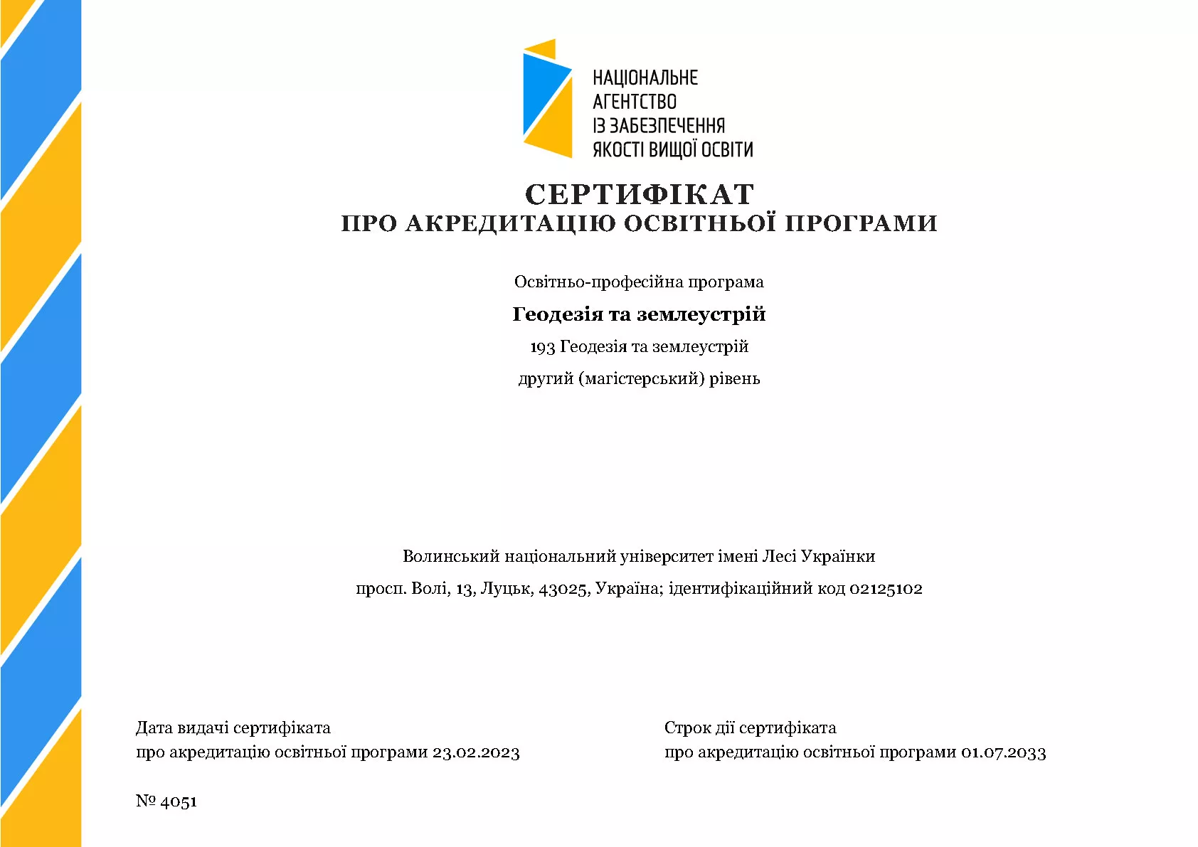
At the second (master's) level of higher education, specialty 193 "Geodesy and land management" of the educational and professional program "Geodesy and land management", students are trained for a period of 1 year and 4 months. As a result of training, master's graduates receive an educational qualification - "Master of Geodesy and Land Management" and a professional qualification - "Geodesic Engineer. Land Surveying Engineer".
At the third (Doctor of Philosophy PhD) level of higher education, specialty 193 "Geodesy and Land Management" of the educational and scientific program "Geospatial Modeling, Land Monitoring and Territorial Management" training of graduate students is carried out for a period of 4 years. As a result of training, post-graduate students receive an educational qualification - "Doctor of Philosophy (PhD)".

The department provides education for students in full-time and part-time, budget and contract forms of education of the appropriate level of higher education, reading normative and selective disciplines of general and professional training, conducting educational practices on the basis of the sports and health camp "Hart" (Svityazh village, Shatsky district, Volyn region), a specialized educational and scientific training ground in the 900th anniversary park of the city of Lutsk, as well as industrial and pre-diploma internships in leading institutions, organizations and enterprises of the city of Lutsk and the Volyn region.

Strategy for the development of the educational and professional programs "Geodesy and land management" and the educational and scientific program "Geospatial modeling, land monitoring and territory management"


Title
Excerpts from the minutes of meetings and seminars of the department
Subsection
Title
Material and technical equipment
Subsection
Body

Title
Research Laboratory of Applied Photogrammetry and Geoinformatics
Subsection
Body

Research Laboratory of Applied Photogrammetry and Geoinformatics

Staffing of the laboratory
Uhl Anna, Doctor of Technical Sciences, Professor, Head of the Department, Head of the Laboratory

Ivanchuk Oleh, Doctor of Technical Sciences, Professor

Voloshyn Volodymyr, Candidate of Technical Sciences, Associate Professor

Korol Pavlo, Candidate of Geographical Sciences, Associate Professor

Melnyk Oleksandr, Candidate of Technical Sciences, Associate Professor

Radzii Volodymyr, Candidate of Geographical Sciences, Associate Professor

Denysiuk Ruslana, Engineer

The main purpose of the laboratory is

Scientific and methodological support of innovative training programs for land surveying engineers and training of scientific and pedagogical staff

Main directions of the laboratory activity

Development of the theory and practice of digital quantitative interpretation of SEM images, three-dimensional reconstruction of micro-objects by means of GIS technologies, modeling and mapping of gradation processes and study of the structural organization of the soil cover of Volyn, implementation of engineering and geodetic support of critical engineering structures and mathematical and cartographic modeling by means of GIS.

Main results of the project
The technology for determining the volume of leached soil based on the combined universal soil loss equation CUSLE using minimum data on individual plots of certain sizes commensurate with the area of agricultural land in settlements, village and town councils, and individual farms allows determining the average long-term volume of leached soil.

The technology of determining the volume of washed away soil through the superposition of submodels-factors based on R-functions based on minimal data on individual plots of certain sizes that are commensurate with the area of agricultural land of settlements, village and town councils, individual farms (terrain and soil erosion map) and semi-empirical correlations between the parameters of three factors (erosion potential of precipitation, soil erosion, and terrain), it is possible to determine the average long-term volume of soil washed away.

Research work funded by customers

  • Research work "Field studies of flora, fauna and biodiversity, habitats, migration in the territory of the planned activity "Peat extraction at the Koza-Berezina field" 2021
  • Research work on the topic "Monitoring of the site of the planned activity at the facility "Overhaul of the Turia Riverbed in the area of Sahaidachnoho Street in Kovel, Volyn region" of biological indicators: composition and average quantitative indicators of floating salvinia habitats and other aquatic and near-water plant communities" (Contract No. 267-4F of 30.07.2021)
  • Research work (RW) on the topic "Survey of the work area Manevytska-1, Manevytska-2, Kamen-Kashyrska-1, Kamen-Kashyrska-2, peat bog "Velyke Bahno" (Contract No. 21-4F of 27.01.2022)
  • Research and development work on the topic: Monitoring of the site of implementation of the planned activity at the facility "Overhaul of the Turia Riverbed in the area of Sahaidachnyi Street in Kovel, Volyn region" of biological indicators: composition and average quantitative indicators of floating salvinia habitats and other aquatic and near-water plant communities (Contract No. 53-4F of 02.05.2022)
  • Research work on the topic: "Assessment of the current ecological state of the Luha River within the city of Volodymyr" (Contract No. 228-2F of 15.11.2022).
  • Research work on the topic: "Field studies of the flora, fauna and biodiversity of the Rylovytsia River from Pryvokzalna Street to the Rylovytsia Island Recreation Park in Volodymyr, Volyn Oblast" (Contract No. 229-2F of 15.11.2022).

Equipment of the laboratory and types of services that can be provided by the laboratory
Photogrammetric station "Delta" with appropriate software

  • Creation of modern cartographic models (maps), construction of a digital terrain model, determination of the volume of washed away soil for agricultural producers, processing of remote sensing data, training in the work at the Delta PVS and Digitals (for the creation of master plans for settlements)

Regulations on the Research Laboratory of Applied Photogrammetry and Geoinformatics of Lesya Ukrainka Volyn National University

Report on work 2019-2022

Plan of the Laboratory of Photogrammetry and Geoinformatics 2021-2022 academic year

Plan of the Laboratory of Photogrammetry and Geoinformatics 2022-2023 academic year
 

Title
Certificates of accreditation
Subsection
Body
магістр


Image
Uhl Anna